 Generative Adversarial Network synthesized samples of the cosmic web
Abstract
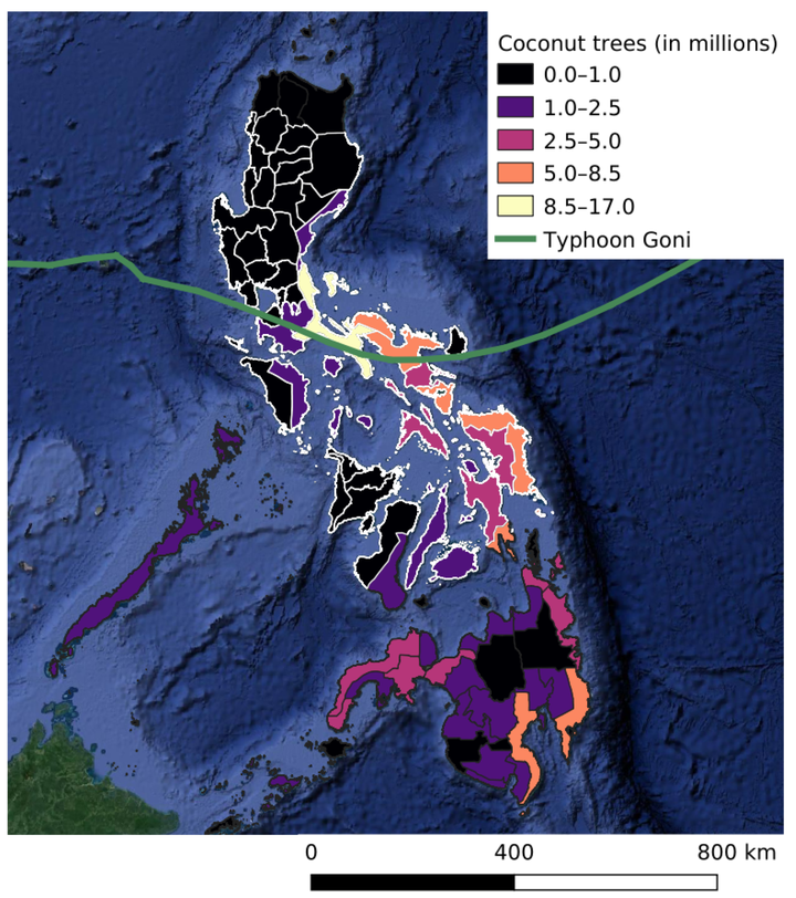
Typhoon Goni crossed several provinces in the Philippines where agriculture has high socioeconomic importance, including the top-3 provinces in terms of planted coconut trees. We have used a computational model to infer coconut tree density from satellite images before and after the typhoon’s passage, and in this way estimate the number of damaged trees. Our area of study around the typhoon’s path covers 15.7 Mha, and includes 47 of the 87 provinces in the Philippines. In validation areas our model predicts coconut tree density with a Mean Absolute Error of 5.9 Trees/ha. In Camarines Sur we estimated that 3.5 M of the 4.6 M existing coconut trees were damaged by the typhoon. Overall we estimated that 14.1 M coconut trees were affected by the typhoon inside our area of study. Our validation images confirm that trees are rarely uprooted and damages are largely due to reduced canopy cover of standing trees. On validation areas, our model was able to detect affected coconut trees with 88.6% accuracy, 75% precision and 90% recall. Our method delivers spatially fine-grained change maps for coconut plantations in the area of study, including unchanged, damaged and new trees. Beyond immediate damage assessment, gradual changes in coconut density may serve as a proxy for future changes in yield.